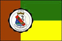
Cidra (Cidra Municipio)
 |
Cidra is known as "El Pueblo de la Eterna Primavera" ("Town of the Eternal Spring") and "El Pueblo de la Paloma Sabanera" ("Town of the Plain Pigeon").
The region of what is now Cidra belonged to the Taíno region of Cubuy, which covered a portion of the center of Puerto Rico. The region was led by cacique Caguax.
There are not many records that show that the region was populated after the Spanish colonization. However, it is believed that around 1795, a Catalan named Frujols built a hermitage or shrine around which a small village settled. The settlement became a ward of Cayey, until 1807 when the residents gave the power to Victoriano de Rivera to ask the Governor for permission to found an independent town. In 1809, a landowner known as Bibiana Vázquez donated the land needed for the foundation, and Governor Salvador Meléndez approved the petition. Victoriano de Rivera was appointed to lead the town, but he was quickly replaced by Wenceslao Vázquez due to illness.
At the time of its foundation, Cidra had 26 houses and 11 huts. It is believed that its name is derived from the citron fruit which was widely cultivated in the region. During the years following its foundation, a church and city hall were built. By 1822, there were already two public schools in town. Two years later, a road communicating the town with Caguas was opened. In 1868, the population of Cidra was more than 5,000 residents, which included European immigrants and slaves.
Puerto Rico was ceded by Spain in the aftermath of the Spanish–American War under the terms of the Treaty of Paris of 1898 and became a territory of the United States. In 1899, the United States conducted its first census of Puerto Rico finding that the population of Cidra was 7,552.
In 1902, the Legislative Assembly of Puerto Rico approved a law for the consolidation of certain municipalities. As a result, Cidra was again incorporated to the town of Cayey. However, in 1905 a new law revoked the previous one, turning Cidra into an independent municipality again.
Map - Cidra (Cidra Municipio)
Map


Country - Puerto Rico
 |
 |
Currency / Language
| ISO | Currency | Symbol | Significant figures |
|---|---|---|---|
| USD | United States dollar | $ | 2 |
| ISO | Language |
|---|---|
| EN | English language |
| ES | Spanish language |